This week, Microsoft unveiled an update to its business intelligence service within Office 365, which is intended to help customers more easily track down data about their business. “Power BI” for Office 365 is currently in preview, but lets businesses drill down for easy-to-consume information about their operations. The main component of Power BI is Excel, and today’s update provides users with color-coded 3D mapping capabilities that will likely jazz up any presentation! Don’t bore audiences with a normal, plain chart! Thanks to Office 365’s newest update, charts and maps will surely be attention grabbers in any meeting.
The Power Map feature, previously known as “GeoFlow,” allows for region-based visualization tools that color-code geo-political areas including ZIP codes, counties, states, countries, and regions. Rather than a flat pie or bar chart, Power Map allows users to plot data points with Bing Maps to bring them to life- literally! Steer away from the usual, boring graphs and charts and use Power Map to beautifully display location settings with easy-to-use Power Map!
Power Map not only allows charts, maps and graphs to be 3D and in color— videos too! Whether compiling a presentation video or a slideshow, Power Map allows its users to create videos and share across all social media platforms.
“Power Map now enables customers to create videos that can be optimized for a number of devices and shared through social media, PowerPoint slides, and Office 365,” a Microsoft spokeswoman said.
[php snippet=8]Related Content
 Enhance Your Business With SaaS There are many benefits to using the Software as a Servic (SaaS) for all businesses. We narrowed down the […]
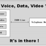 Top 5 Benefits of PRI With an ISDN PRI, your business not only increases its flexibility and cost savings, you are also receiving […]
![Hosted VoIP Price Comparison [Video] – Part 3](https://www.aerocominc.com/info/wp-content/uploads/2018/09/Hosted-VoIP-Price-Comparison-Part-3-thumbnail-150x150.jpg) Hosted VoIP Price Comparison [Video] – Part 3 In this 3rd part of a 3 part series, Mike provides expert insight into the 3 things you need to know about […]
Hosted VoIP Price Comparison [Video] – Part 3 In this 3rd part of a 3 part series, Mike provides expert insight into the 3 things you need to know about […] The Future of Hybrid Cloud
Cloud computing has taken the business world and revolutionized the ways of storage and […]
The Future of Hybrid Cloud
Cloud computing has taken the business world and revolutionized the ways of storage and […] Why MPLS is the Best Investment for Your Business The benefits to switching to a MPLS network have never been clearer! Read here how to you will receive a […]
 IT Spending on the (Slight) Rise
CIO Magazine performed a survey and 48 percent of CIOs that were questioned said that in 2013 they […]
IT Spending on the (Slight) Rise
CIO Magazine performed a survey and 48 percent of CIOs that were questioned said that in 2013 they […]